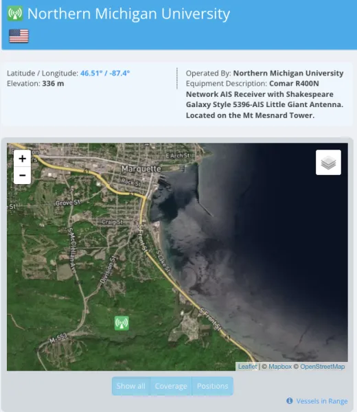
Northern Michigan University has added an Automatic Identification System (AIS) receiving station to the university's Mt. Mesnard tower in South Marquette as a safety tool to help boaters detect marine traffic they are likely to encounter.
Since the tower was already being used for NMU's Educational Access Network, AIS was easy to install, with most of the installation being a small antenna added to the tower. While it's not required for everybody with a boat, AIS systems are becoming more and more popular with marine enthusiasts with the equipment coming down in cost and being a safety feature.
“There's a class “A” for commercial ships, like ore freighters who are required to have one installed and class “B” for private vessels, you know, pleasure boaters,” said Eric Smith, NMU's LTE project replacement coordinator. “Those with AIS systems on their boat are transmitting their GPS-enabled location, as well as who they are, the direction they're traveling and how fast they're going. If you're out on the lake and you have this equipment on your boat, you'll be able to see other AIS-equipped boats in a 40-60 mile radius. It makes it much safer in adverse weather conditions like fog or during the nighttime where your visibility is limited or obscured.“
Pleasure boaters can also use the AIS system to let their loved ones know their location and status while cruising. Smith used the example of someone going fishing and the family looking up their location on a website like Marinetraffic.com and making sure that they're doing okay. If the person out fishing is overdue, the family could check to see if their AIS system is working and convey the information to the Coast Guard or 911 to speed up the search and rescue.
Visitors and marine buffs curious about freighter traffic they see on the lake can also use an app on their phone to find out the ship's name, home port, length and destination. Another good thing about it: Northern's AIS receiver will be helping more than just the greater Marquette area.
“It's primarily a public service that the university is providing,” Smith said. “The AIS receivers in Hancock, Gratiot Lake and Paradise near Whitefish Point don't cover the entire Lake Superior. There's lots of uncovered space, largely in the central part of the lake. The height of the NMU's station helps cover the gap, filling in large voids and allowing for frequent marine traffic updates along Lake Superior's shores and the northern part of Lake Michigan.”
The total radius covered by NMU's AIS system is 100 nautical miles (equivalent to about 115 land miles) and it frequently updates over 10,000 vessel positions daily, logging over 100 messages each minute. Currently, Lake Superior's vessel tracking map on Marinetraffic.com looks barren because of the Soo Locks closure until March 25 of this year for seasonal repairs. However, with summer just a few months away, NMU's recent contribution to collecting and distributing vessel traffic data will be a welcome addition to the AIS community.
Learn more about NMU's AIS system here.

